

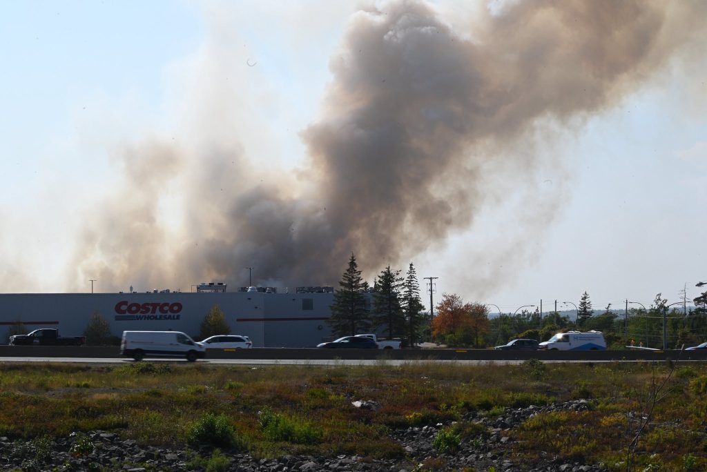
The wildfire currently burning in the Bayer's Lake area has led to a special air quality statement for the Halifax metro and Halifax County West. Environment Canada has reported that the smoke from the wildfire is significantly reducing air quality not only in the immediate vicinity but also in areas downwind of the smoke. This creates variable local smoke concentrations that may fluctuate due to slight changes in wind speed or direction.
Certain groups of people are more vulnerable to the effects of wildfire smoke, particularly those aged 65 and older, pregnant individuals, infants, and young children. Additionally, people with pre-existing health issues or chronic conditions, as well as those engaged in outdoor work, are advised to minimize strenuous outdoor activities. Those experiencing symptoms should seek medical attention promptly.
Given the current conditions, Environment Canada recommends limiting outdoor time and suggests considering the rescheduling or reduction of outdoor sports, activities, and events to mitigate smoke exposure.
On Tuesday, Halifax Stanfield International Airport recorded an official high of 33 degrees Celsius, which broke an existing temperature record. The previous record was 31.5 degrees Celsius, set in 1988. Meanwhile, several areas outside the Halifax Regional Municipality are under a heat warning for the third consecutive day. Although the city itself is not under a heat warning, it is anticipated to experience another warm day.
95.7's weather specialist Allister Aalders has indicated that light winds and high humidity are expected throughout the day, factors which could assist firefighters battling the wildfire. However, the forecast indicates very little rain in the immediate future. Aalders commented, "The only thing missing is the rainfall which we need badly in the Halifax area." He noted that there could be a possibility of a few isolated showers today, but it is not until Thursday night into Friday that a better chance of organized scattered showers is expected. Even then, unless a heavy downpour or thunderstorms occur, rainfall amounts are likely to remain minimal.
The weather forecast suggests continued sunny conditions with temperatures in the mid-20s Celsius anticipated for Friday and the following weekend.


